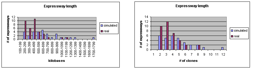
Supplemental Figure 1. Distribution of expressway lengths of the simulated and Syngenta datasets, given in kilobases and number of clones.
Supplmental information to provides additional graphs detailing the results of the minimal tiling path algorithm.
Supplemental Figure 1. Distribution of expressway lengths of the simulated and Syngenta datasets,
given in kilobases and number of clones.
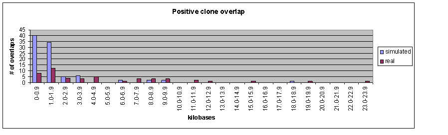
Supplemental Figure 2. Distribution of overlap lengths for positively overlapping clones in expressways.
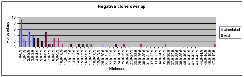
Supplemental Figure 3. Distribution of bridging distances for negatively overlapping clones in expressways.
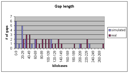
Supplemental Figure 4. Distribution of gap lengths; that is, portions of the map not covered by expressways.
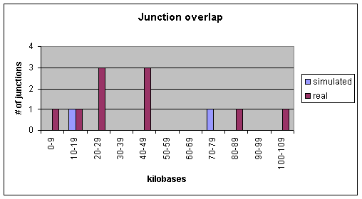
Supplemental Figure 5. Distribution of junction lengths -- amount of overlap between expressways after pruning excess clones.